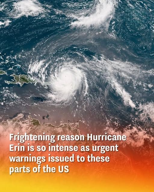
Hurricane Erin has prompted urgent warnings for the U.S. East Coast, the Bahamas, and Atlantic Canada. It rapidly intensified into one of the season’s most dangerous storms, shocking forecasters with its unexpected behavior.
The hurricane underwent a remarkable and rare transformation. It exploded from a Category 1 system into a powerful Category 5 storm within just 24 hours. It has since weakened slightly but remains a major threat.
The National Hurricane Center has issued alerts for life-threatening surf and rip currents. Flash flooding is expected in the northern Leeward Islands, the Virgin Islands, and Puerto Rico, with additional risks of landslides in mountainous areas.
This rapid intensification, defined by a wind increase over 35 mph in a day, was fueled by warm ocean water and low wind shear. These ideal conditions made the storm’s explosive growth difficult to predict.
While not forecast to make direct U.S. landfall, Erin’s enormous wind field is still a significant hazard. It is expected to cause coastal flooding, severe beach erosion, and dangerous waves as it moves north.
Meteorologists are comparing Erin to past destructive storms like Hurricane Milton, which caused catastrophic damage without a direct hit. This underscores the threat posed by powerful offshore systems.
As of August 17th, Erin is a Category 3 hurricane. However, forecasters warn it could restrengthen into a Category 5 as it travels over warm Atlantic waters. Officials are urging constant vigilance and preparedness for coastal communities.